3.4.5.2.1 Groundwater
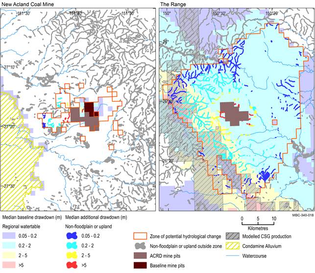
Outside of the modelled open-cut mine pits, non-floodplain or upland riverine landscapes that are potentially impacted cover 12 km2 (which is 0.4% of the landscape group in the assessment extent) of remnant vegetation and 477 km (2.0%) of streams, which are predominantly not groundwater dependent (Figure 31 and Table 8). Most of the remnant vegetation in the zone (11 km2) is dependent on local groundwater flow systems in the alluvium or Main Range Volcanics aquifers or is associated with non-floodplain wetlands. Most streams in the zone are not groundwater dependent (469 km) and so are unlikely to be affected by groundwater drawdown. None of the ‘Non-GAB springs’ associated with the Main Range Volcanics basalt aquifers are contained within the zone of potential hydrological change.
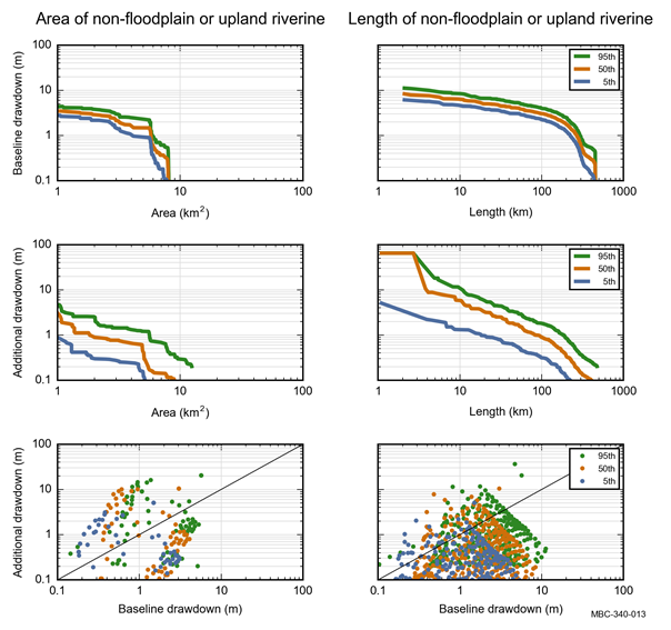
The median (50th percentile) estimate of exceeding 0.2 m drawdown due to additional coal resource development includes 5 km2 of remnant vegetation and 256 km of stream network (Table 17). Median drawdown due to additional coal resource development is less than 2 m, with the exception of 1 km2 of remnant vegetation adjacent to the modelled open-cut mine pits (Figure 31).
Drawdown under the baseline is less than 2 m for most remnant vegetation and streams in this landscape group (Figure 32). Median baseline drawdown in excess of 2 m covers 3 km2 of remnant vegetation and 182 km of stream network in this landscape group (Table 16.
Median is the 50th percentile. Baseline drawdown is the maximum difference in drawdown (dmax) under the baseline relative to no coal resource development. Additional drawdown is the maximum difference in drawdown (dmax) between the coal resource development pathway (CRDP) and baseline, due to additional coal resource development. The mine pits in the CRDP are the sum of those in the baseline and the additional coal resource development (ACRD). Landscape classes within modelled open-cut mine pits are not included in this analysis.
ACRD = additional coal resource development, CSG = coal seam gas, GAB = Great Artesian Basin, GDE = groundwater-dependent ecosystem
Data: Bioregional Assessment Programme (Dataset 1, Dataset 2, Dataset 3, Dataset 4, Dataset 8, Dataset 9)
Baseline drawdown is the maximum difference in drawdown (dmax) under the baseline relative to no coal resource development. Additional drawdown is the maximum difference in drawdown (dmax) between the coal resource development pathway (CRDP) and baseline, due to additional coal resource development. Landscape classes within modelled open-cut mine pits are not included in this analysis. GAB = Great Artesian Basin, GDE = groundwater-dependent ecosystem
Data: Bioregional Assessment Programme (Dataset 7)
Table 16 ‘Non-floodplain or upland riverine (including non-GAB GDEs)’ landscape group: area (km2), stream network length (km) and number of springs (number) that exceed the 5th, 50th and 95th percentile estimates of baseline drawdown in the zone of potential hydrological change
aExtent could be a number, length or area and excludes modelled open-cut mine pits.
Baseline drawdown is the maximum difference in drawdown (dmax) under the baseline relative to no coal resource development. Landscape classes within modelled open-cut pits are not included in this analysis. Due to rounding, some totals may not correspond with the sum of the separate numbers.
GAB = Great Artesian Basin, GDE = groundwater-dependent ecosystem
Data: Bioregional Assessment Programme (Dataset 7)
Table 17 'Non-floodplain or upland riverine (including non-GAB GDEs)' landscape group: area (km2), stream network length (km) and number of springs (number) that exceed the 5th, 50th and 95th percentile estimates of additional drawdown in the zone of potential hydrological change
aExtent could be a number, length or area and excludes modelled open-cut pits.
Additional drawdown is the maximum difference in drawdown (dmax) between the coal resource development pathway (CRDP) and baseline, due to additional coal resource development. Landscape classes within modelled open-cut mine pits are not included in this analysis. Due to rounding, some totals may not correspond with the sum of the separate numbers.
GAB = Great Artesian Basin, GDE = groundwater-dependent ecosystem
Data: Bioregional Assessment Programme (Dataset 7)
3.4.5.2.2 Surface water
No surface water numerical modelling was undertaken for the Maranoa-Balonne-Condamine subregion. Some potential hydrological changes may, however, be specified conceptually based on scientific logic as described in Section 3.3.
