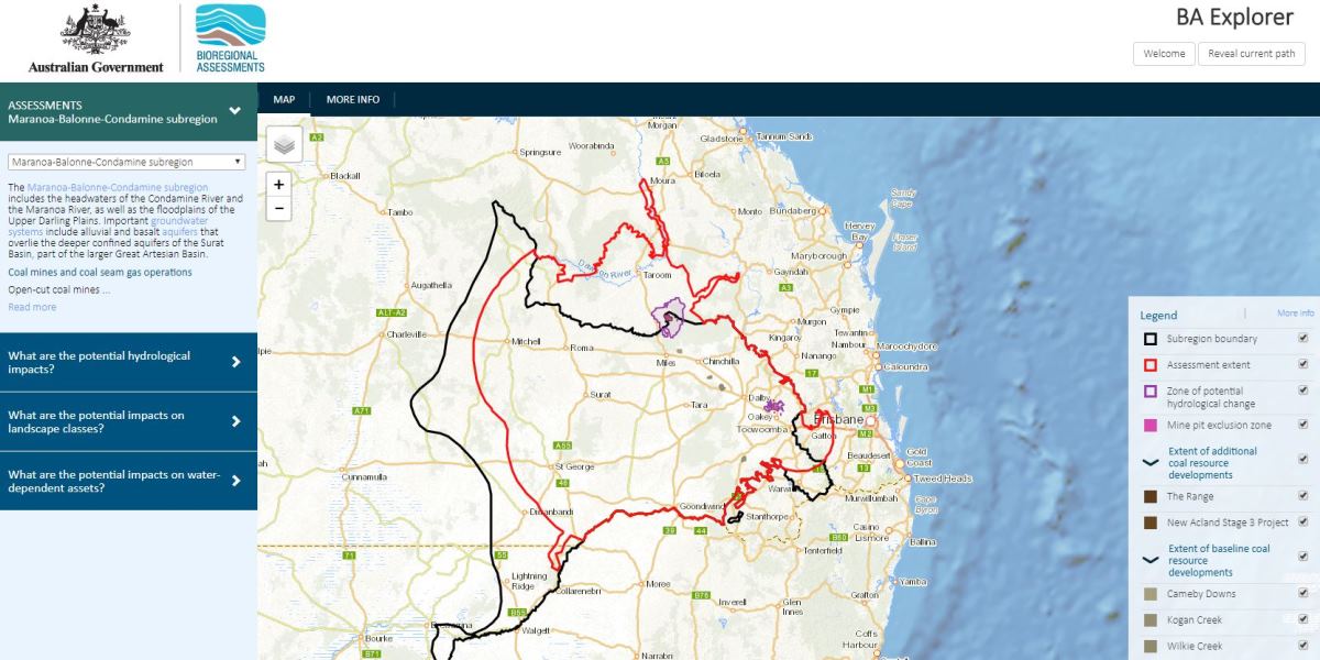
The Bioregional Assessment (BA) Explorer is a mapping tool that displays results of the bioregional assessment for the Maranoa-Balonne-Condamine, Gloucester, Hunter, Galilee and Namoi subregions.
https://explorer.bioregionalassessments.gov.au/
What will you see in BA Explorer?
BA Explorer displays information about how groundwater levels and surface water flows might change as a result of coal seam gas and coal mining development. Results are reported as probabilities – the percent chance that a specified change will happen. Users can choose to show changes that have a 5% chance, a 50% chance or a 95% chance of happening.
The zone of potential hydrological change is the area where changes in groundwater or in surface water cannot be ruled out (which means there is at least a 5% chance that change will exceed thresholds).
Ecosystems, represented by landscape classes, and water-dependent assets are overlaid on this zone. Overlaps indicate where further work using more detailed local-scale information is needed to understand whether there will be impacts and how large they might be.
Tips for using the BA Explorer
- Look for the ‘MORE INFO’ links and tabs for definitions and more detailed explanations.
- For the landscape class query, look for the tab titled ‘LANDSCAPE PROFILE’ to understand how much of a landscape class may experience changes in water. Results for relevant hydrological response variables are available for download as a csv file.
- For the water-dependent asset query, look for the tab titled ‘ASSET PROFILE’ to understand how much of an asset may experience changes in water. Results for relevant hydrological response variables are available for download as a csv file.
Technical details
Ruling out impacts
The assessments rule out impacts on water resources and water-dependent assets in areas that are very unlikely to experience hydrological change (areas with a less than 5% chance of change). Within the zone of potential hydrological change, there may be changes in groundwater drawdown or surface water flow, but this does not necessarily mean that assets or landscape classes will be impacted. Further local-scale investigation may be required to understand these impacts. Governments, industry and the community can focus on those areas that are potentially impacted and apply local-scale modelling and knowledge when making regulatory, water management and planning decisions.
Changes closer to the surface
BA Explorer shows the modelled extent of groundwater drawdown in the regional watertable. This is where most ecosystems and assets source their groundwater. Information on the potential changes to deeper aquifers can be found in the technical products.
Point-in-time assessment
Bioregional assessments are based on information available at a point in time. Up-to-date information on water-dependent assets (such as streams and bores) and landscape classes may be available from their original sources. Check the details of each assessment to understand the data and methodologies used, the assumptions made and the gaps in available information.
Variations of results between technical products and BA Explorer
There may be some small differences between the results displayed by BA Explorer and the results reported in the impact and risk analysis (product 3-4) and outcome synthesis (product 5). These differences arise from minor changes in the calculations required for rapid display on BA Explorer.
User support and documentation
BA Explorer is designed to be used alongside the other products of the bioregional assessments. Reading the outcome synthesis (product 5) will help you to understand results on the BA Explorer.
BA Explorer presents the data contained within the impact and risk analysis database of each assessment. The impact and risk analysis database documentation provides details and explanation about the databases, their structure, and the naming of tables and columns.
See the technical products and methodologies to understand how the information has been developed.

