There are 12 stream gauging stations in the non-tidally influenced parts of the Richmond river basin with more than ten years of reliable daily streamflow data between 1980 and 2012 (Table 26). The location of these gauges is shown in Figure 62. Details and mean annual flows for these stations are summarised in Table 27. There are numerous minor tributaries which are ungauged or where the corresponding gauging station has now closed.
The Richmond River at Casino is the furthest point downstream on the main branch of the Richmond River above the influence of the tide. There are tidal influences in the Richmond River from around 4 km downstream of Casino (Manly Hydraulics Laboratory, 2006). The mean annual flow of the Richmond River at Casino is 591 GL.
Tidal influence also extends up the Wilsons River tributary upstream of the town of Lismore. The flow from the Wilsons River, which joins the Richmond River further downstream near Coraki is represented by Coopers Creek at Ewing Bridge (152 GL/year), Coopers Creek at Repentance (77 GL/year) and Wilsons River at Eltham (189 GL/year).
Table 26 Years of streamflow data for selected gauging stations in the Richmond river basin
Data: Bioregional Assessment Programme (Dataset 1)
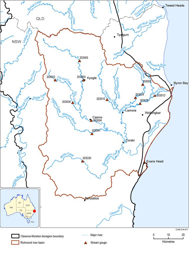
Figure 62 Richmond river basin showing the locations of a selection of key stream gauging stations
Data: NSW Office of Water (Dataset 2)
Table 27 Mean annual streamflow for stations in the Richmond river basin that have more than ten years of available data between 1980 and 2012
Data: NSW Office of Water (Dataset 3)
