The observed data for the Clarence-Moreton bioregion are mainly from the Queensland and NSW state groundwater databases (Bioregional Assessment Programme, Dataset 2; Bureau of Meteorology, Dataset 1; NSW Hydstra and NSW WDTF) collected by the Bureau of Meteorology. As data collection ceased in November 2013, data received after November 2013 were not included in the analysis. Only bores with enough data to determine screen intervals or bore depth were used in the analysis (Table 10) as these data are necessary to assign a bore to particular aquifers. In the absence of bore screen data, the bore was assigned to an aquifer based on the depth of the bore if this information was deemed reliable and plausible. Seven screen codes are used to indicate different bores in terms of their spatial relationship with a particular aquifer. They are:
- I: bores with screen intervals inside the aquifer
- T: bores with a screen top inside the aquifer
- B: bores with a screen bottom within the aquifer
- E: bores with screen intervals penetrating the entire aquifer
- BOI: bores with their bottom inside the aquifer although without screen information in the database
- DS: aquifer assignment for a bore sourced directly from the state database where the bore is only open to a single aquifer
- DM: aquifer assignment for a bore sourced directly from the state database where the bore is screened to multiple aquifers.
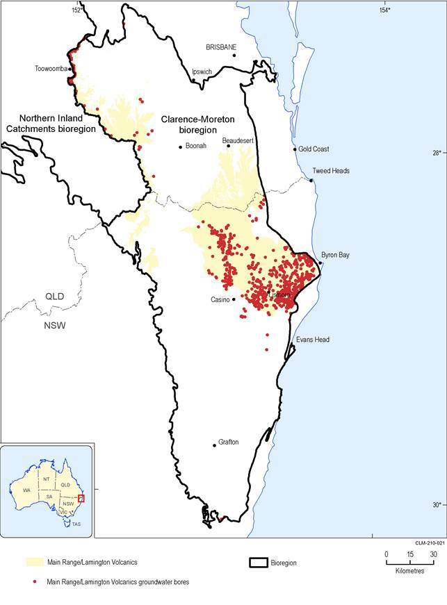
The alluvium, Main Range / Lamington Volcanics and Woogaroo Subgroup represent the three most targeted aquifers with 3536, 921 and 868 associated bores, respectively. The mean of bore depths is less than 50 m and the 90th percentile of bore depth is around 120 m (Figure 21). Therefore, most bores in the Clarence-Moreton bioregion are relatively shallow with respect to the basin basement depth (2–4 km). Most bores are screened to either the alluvium or the outcrops of underlying bedrock aquifers. The shallow reach of bedrock bores is also demonstrated by their spatial distribution along the aquifer boundary. Figure 22 to Figure 28 display the spatial distribution of bores with construction information in major aquifers.
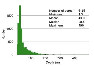
Figure 21 Histogram showing the distribution of bore depths in the Clarence-Moreton bioregion
The inset shows the corresponding statistical summary. Three bores RN22500, RN75903 and RN124727, with respective depths of 1202 m, 805 m and 518 m, have been excluded from the plot for increased figure resolution.
Data: Bureau of Meteorology (Dataset 1), Queensland Department of Natural Resources and Mines (Dataset 3)
Table 10 Number of bores with screen and/or depth information grouped by aquifers
The depth column presents the depth range of bores associated with a specific aquifer. Bores with different screen codes have been counted separately.
Screen codes are: (I) bores with screen intervals inside the aquifer; (T) bores with a screen top inside the aquifer; (B) bores with a screen bottom within the aquifer; (E) bores with screen intervals penetrating the entire aquifer; (BOI) bores with their bottom inside the aquifer although without screen information in the database; (DS) aquifer assignment for a bore sourced directly from the state database where the bore is only open to a single aquifer; (DM) aquifer assignment for a bore sourced directly from the state database where the bore is screened to multiple aquifers.
Data: Bureau of Meteorology (Dataset 1), Queensland Department of Natural Resources and Mines (Dataset 3)
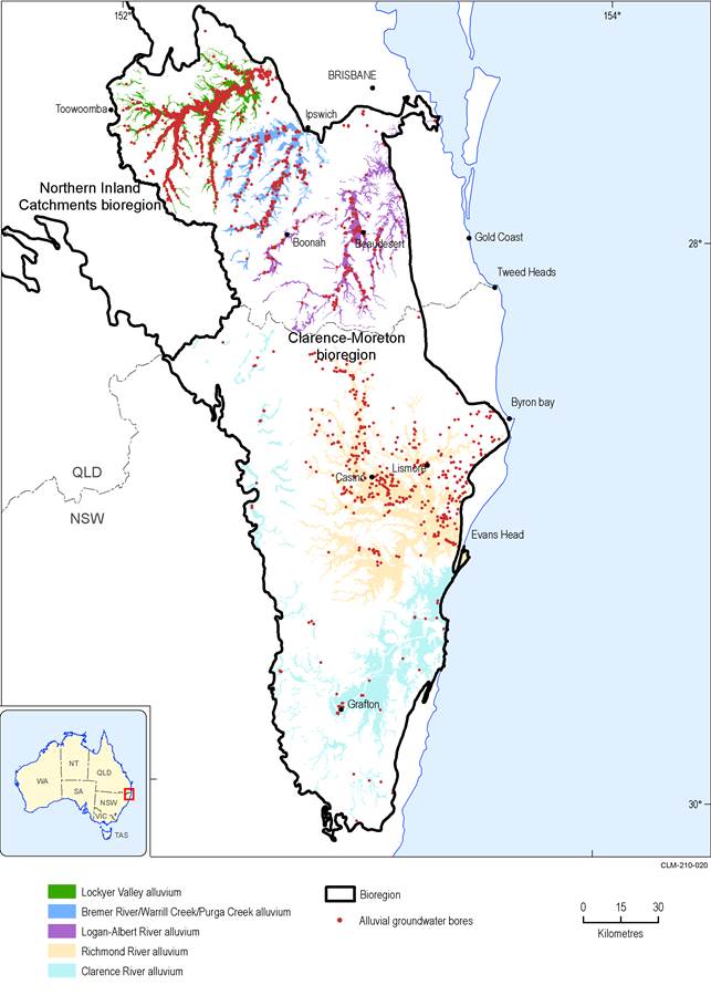
Figure 22 Spatial distribution of bores with construction information in the alluvial aquifers
Data: Bioregional Assessment Programme (Dataset 4)
Data: Bioregional Assessment Programme (Dataset 4)
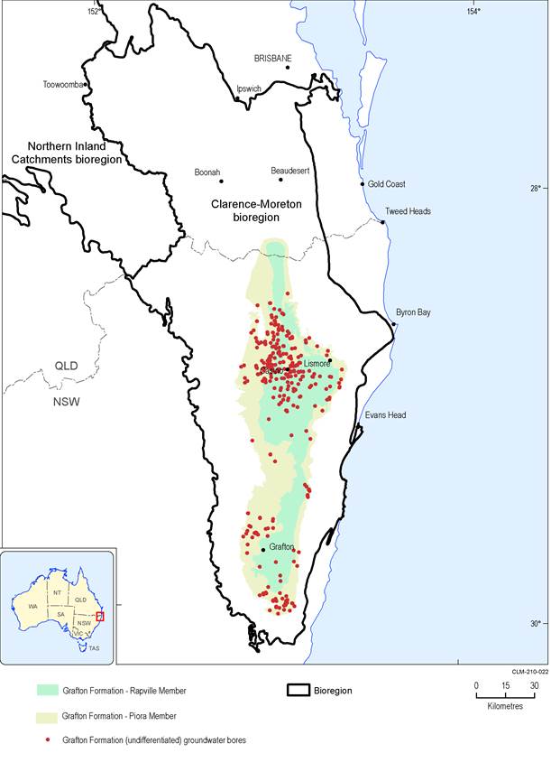
Figure 24 Spatial distribution of bores with construction information in the Grafton Formation
The presence of Rapville Member and Piora Member is mainly limited to NSW.
Data: Bioregional Assessment Programme (Dataset 4)
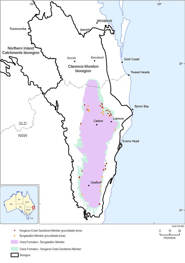
Figure 25 Spatial distribution of bores with construction information in the Orara Formation
This formation is mainly present in NSW.
Data: Bioregional Assessment Programme (Dataset 4)
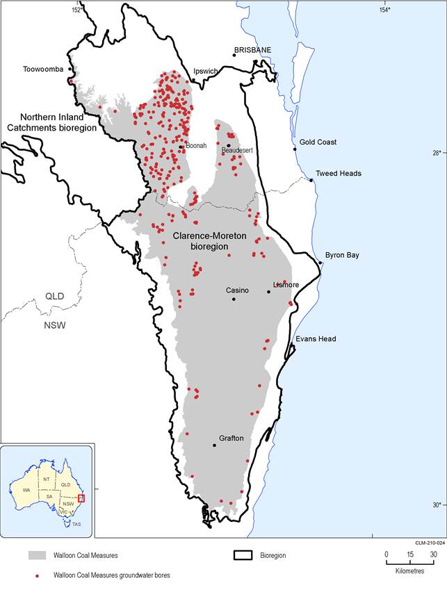
Figure 26 Spatial distribution of bores with construction information in the Walloon Coal Measures
Data: Bioregional Assessment Programme (Dataset 4)
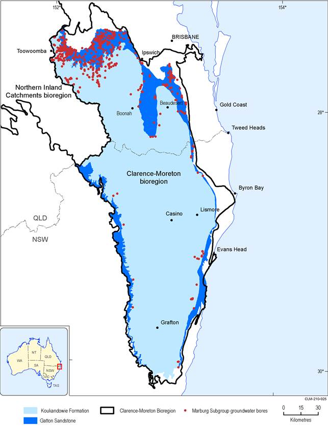
Figure 27 Spatial distribution of bores with construction information in the Marburg Subgroup
Data: Bioregional Assessment Programme (Dataset 4)
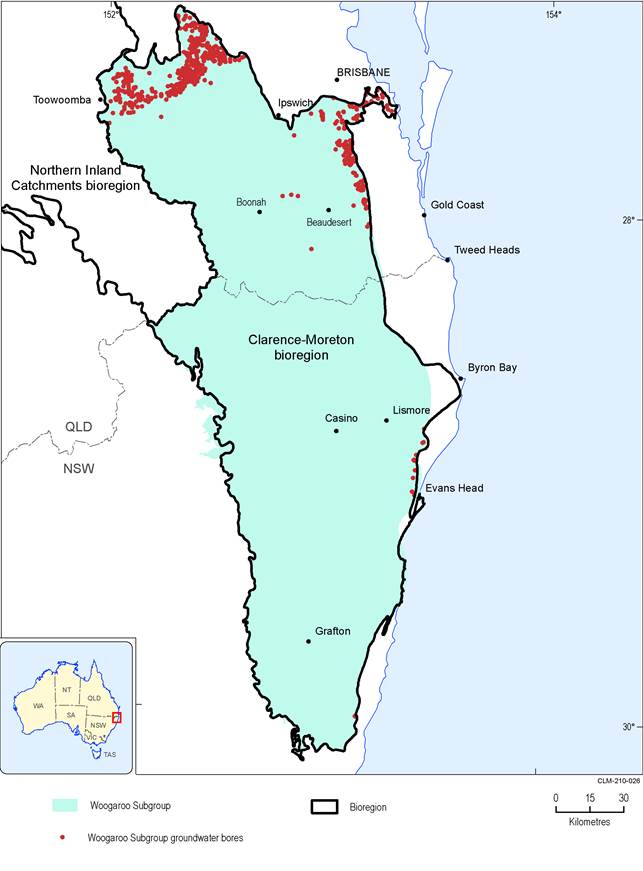
Figure 28 Spatial distribution of bores with construction information in the Woogaroo Subgroup
Data: Bioregional Assessment Programme (Dataset 4)
