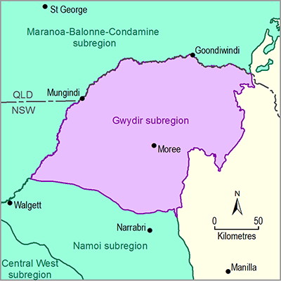
The Gwydir river basin contributes about 3.4% of total runoff in the MDB. The average surface water use is 300 GL/year which is about 60% of total irrigation water entitlements (CSIRO, 2007). At Pallamallawa, the main channel of the Gwydir River flows at its maximum mean daily flow capacity of 2.05 GL (Green et al., 2011) before the flow diversion into its several distributaries begins. The surface water flow regime has changed since the construction of the Copeton Dam in 1973, creating a noticeable reduction in the frequency and magnitude of large flows (MPSC, 2008; Green et al., 2011).
Rainfall in the Gwydir river basin is summer dominated with a mean annual rainfall of 644 mm. On average, the first half of the 20th century was drier than the second half (see Section 1.1.2 Geography for more detail). The mean annual modelled runoff is 41 mm and is relatively uniformly distributed throughout the year (CSIRO, 2007). The runoff coefficient is 6.3% which is higher than in the Maranoa-Balonne-Condamine subregion to the north.
There are 60 active stream gauging stations in the Gwydir river basin, 33 of which are within the subregion. Similarly, about 16 of the 43 stream gauging stations in the Macintyre-Barwon river basin are within the subregion. These stations are managed by the NSW Office of Water and the majority of them are telemetered. The record lengths vary from a few years to more than 100 years. Several of the stations however, have stage only data. Summary statistics from some of the streamflow gauging stations in the subregion are given in Table 15. Full details can be found in NSW Government (2014b).
The impact of climate change examined by the South Eastern Australian Climate Initiative (SEACI) for the Gwydir river basin indicated that 11 of 15 global climate models (GCMs) projected a decrease in future runoff showing a median reduction of 10% and 17% under 1 and 2 degree global warming, respectively (Post et al., 2012). See Section 1.1.2.3 (Geography: Climate) for further details. The CSIRO (2007) study also indicated the effect of projected climate change on future runoff in the Gwydir river basin is a likely decrease of mean annual runoff of about 9% for a 2030 climate based on the median estimate.
Table 15 Selected open stream gauging stations within the Gwydir subregion and summary statistics
Source data: NSW Government (2014b)
aCatchment areas for a number of gauging stations cannot be determined.
bThe mean monthly runoff shows some inconsistencies which have not been explored.

