1.1.5.2.1 The Neales-Peake catchment
The waterholes of the Neales-Peake catchment can generally be divided into those that are saline and flushed only during flow events and those that are mostly fresh and may slowly increase in salinity as they lose water to evaporation and transpiration of local flora in periods of no flow. Typically located in the upper reaches of the catchment, the mostly fresh waterholes have salinities similar to those of floodwaters (100 to 200 mg/L), which increases to 500 to 1400 mg/L in periods of little to no flow. The predominantly saline waterholes have maximum observed salinities ranging from 20,000 mg/L at Algebuckina Waterhole to over 250,000 mg/L at Peake Crossing Waterhole. The saline waterholes are found typically in the mid and lower reaches of both rivers. Maximum observed salinity at waterholes for the period 2000 to 2010 is summarised in Table 10.
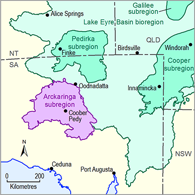
A hypersaline reach separates the fresh from saline waterholes, coinciding with the occurrence of Great Artesian Basin springs, upstream of the Peake-Denison Ranges (which follow the easternmost edge of the Arckaringa subregion) and immediately downstream of poorly channelised reaches of the Neales and Peake that do not contain any waterholes (Costelloe, 2011a). In this reach, saline groundwater discharges into the main channel, which, in periods of no or low flow, is concentrated by evaporation. The presence of a shallow watertable in the hypersaline reach is likely assisted by the presence of relatively impermeable mudstone (Bulldog Shale) underlying the alluvial sediments and also the upward hydraulic gradient from vertical leakage of Great Artesian Basin groundwater. At specific sites, leakage from the Great Artesian Basin is probably also making a small but significant contribution to the alluvial groundwater (Costelloe, 2011a; Smerdon et al., 2012). However, this is probably confined to areas where secondary porosity development via faulting has occurred (Keppel et al., 2013).
Located in the hypersaline reach of the Peake, it can be seen from Table 10 that North Freeling Waterhole is less saline than neighbouring waterholes, Baltucoodna and Peake Crossing. Located some 150 m from the main channel of the Peake, North Freeling is the only artesian groundwater fed waterhole in the Neales-Peake catchment. It is quite shallow (approximately 0.2 m of water depth over a thick underlying bed of mud) and this water level is maintained by Great Artesian Basin inflow (Costelloe, 2011a). During the 2009-2010 floods, the conductivity of the pool was 5150 mg/L (Nov 2009) and this was slightly above the range of the conductivity of nearby springs. The frequency of surface inflow may be sufficient to keep this pool from becoming hypersaline or else there is a sufficient gradient for constant outflow that prevents excessive salinity build-up (Costelloe, 2011a).
Table 10 Maximum observed salinity of waterholes of the Neales-Peake catchment
The salinity of the waterholes downstream of the Peak-Denison Ranges varies significantly. Algebuckina Waterhole is typically fresh, but registers a sharp increase in salinity as a result of saline inflow from the hypersaline reaches during a flood event. Other nearby waterholes, like South Cliff, remain quite fresh even at low water levels.
1.1.5.2.2 Warriner-Margaret Creeks
No water quality data have been recorded in the Warriner-Margaret Creeks area. Anecdotal evidence indicates that water quality is highly variable, with very high salinity observed between flow events (L Sampson, pers. comm., 2013).

Product Finalisation date
- 1.1.1 Bioregion
- 1.1.2 Geography
- 1.1.3 Geology
- 1.1.4 Hydrogeology and groundwater quality
- 1.1.5 Surface water hydrology and surface water quality
- 1.1.6 Surface water – groundwater interactions
- 1.1.7 Ecology
- Citation
- Acknowledgements
- Contributors from the Government of South Australia
- Contributors to the Technical Programme
- About this technical product
