The Arckaringa subregion is located in northern SA (Figure 5), approximately 600 km north north-west of Adelaide and 400 km south of Alice Springs. The subregion area is based on the subsurface extent of the Arckaringa geological basin (Arckaringa Basin), which covers an area of approximately 100,000 km2. The subregion is bordered by a series of ranges, ridges and plateaux that includes the Gawler Ranges to the south and south-west, the Ooldea Ranges to the south-west and west, the Everard Ranges and Central Australian Plateau to the west, the Bitchera Ridge to the north, the Peake and Denison Inlier (Denison and Davenport Range) to the east and the Stuart Shelf to the south-east. A low-rising escarpment of silcrete-capped Cretaceous sediments called the Stuart Range transects the Arckaringa Basin from south to north. The Stuart Range is of particular importance to the Arckaringa subregion as it marks the western limit of the Kati Thanda – Lake Eyre hydrological basin.
Aeolian-driven erosion as described by Mabbutt (1977) is an important process shaping the physiology of the region. Consequently, the topography of the Arckaringa subregion is largely flat-lying, with dominant landscape features controlled by longitudinal and lunette dune fields or gravelly (‘gibber’) plains and tablelands. These environments support perennial grasses and sparse chenopod, samphire or saltbush shrubland vegetation (Marla-Oodnadatta Soil Conservation Board, 2002). Ground elevation across the subregion ranges between 20 mAHD and 380 mAHD. Additionally, anastomosing channels that form wide, gently sloped valleys, swales and floodplains also provide topographic variability. These environments support stands of coolabah, Gidgee and small areas of River Red Gum vegetation (Marla-Oodnadatta Soil Conservation Board, 2002).
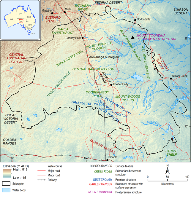
Figure 5 Physical geography of the Arckaringa subregion
The subregion boundary used in this and following maps is a more detailed representation (than that used in the preceeding maps) based on the extent of the Pedirka geological basin
