Breadcrumb
The Arckaringa subregion is located entirely in SA (Figure 4), and is defined by the extent of the Arckaringa geological basin (see Section 1.1.1for further detail). The subregion spans an area of about 82,505 km2 and extends west beyond the Kati Thanda – Lake Eyre surface drainage catchment into the Gairdner surface drainage catchment. The whole of the Arckaringa geological basin is though included within the Lake Eyre Basin bioregion.
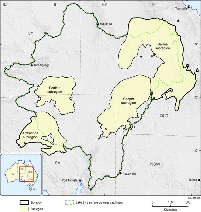
Figure 3 Lake Eyre Basin bioregion and subregions
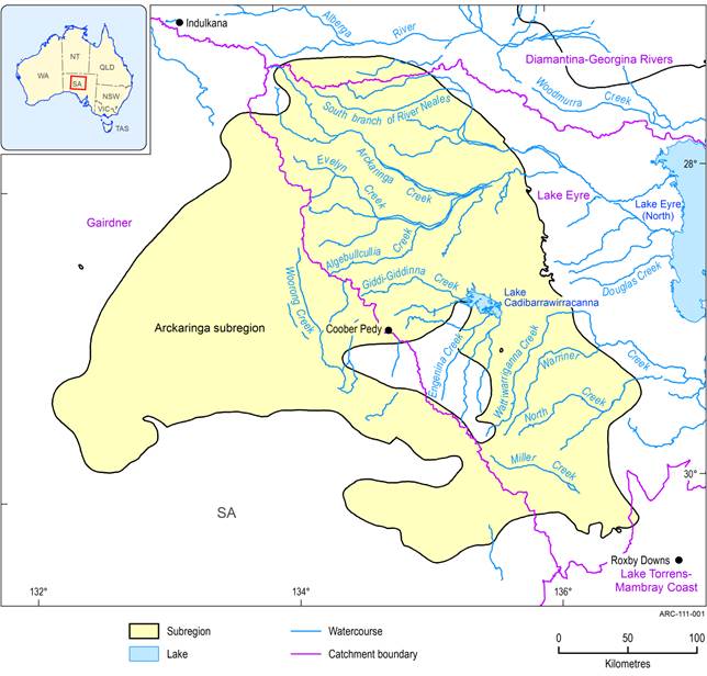
Figure 4 Arckaringa subregion showing surface water catchments
Last updated:
5 January 2018

Summary and download
Product Finalisation date
2015
PRODUCT CONTENTS
ASSESSMENT
ASSESSMENT COMPONENT