The information summarised in this section was obtained from Duralie Coal Mine Water Management Plan (Duralie Coal, 2013) and Heritage Computing (2009). Duralie Coal Mine (DCM) water management is designed and operated to control water generated from surface development areas via on-site water storage. The other objective of the DCM Water Management Plan is to prevent overflow of dirty water generated within the mine workings, waste rock emplacements, water storage areas and runoff from areas where coal is handled, to the neighbouring water sources of Coal Shaft Creek or Mammy Johnsons River.
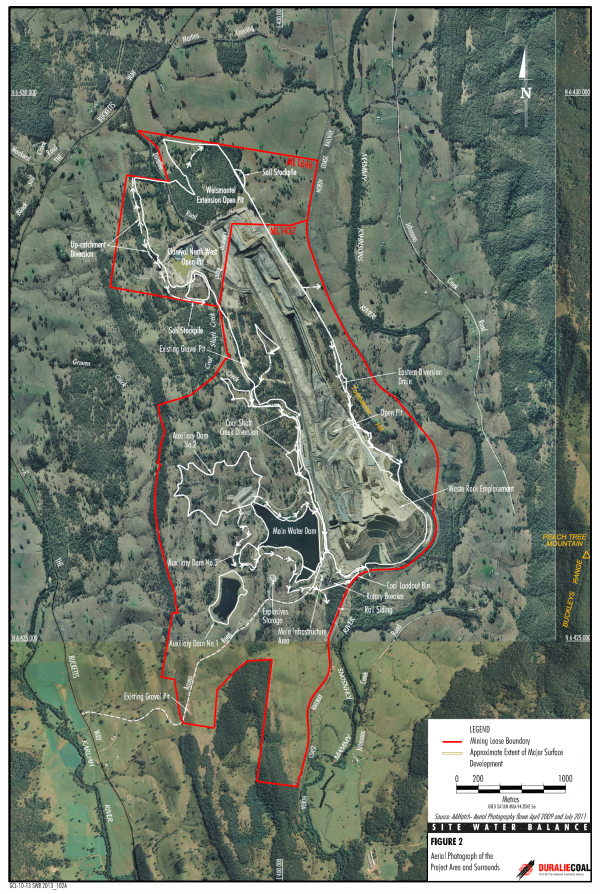
The water management system includes a combination of permanent structures that will continue to operate post closure and temporary structures that will only be required until the completion of rehabilitation works. The principal water storage areas are (Figure 17):
- Main Water Dam (MWD), located north-west of the main infrastructure area and has a constructed capacity of up to approximately 1405 ML
- Auxiliary Dam No. 1 (AD1), located upslope of the MWD and has a constructed capacity of 462 ML (with an approved capacity up to 500 ML)
- Auxiliary Dam No. 2 (AD2), located upslope of the MWD (on a different drainage line to AD1) and has a constructed capacity of 2724 ML (with an approved capacity up to 2900 ML)
- Sediment Dams – Waste Rock Emplacement (VC1), Rail Siding (RS1 & RS6)
- a smaller bunded area located in the south of the MWD, adjacent to the main infrastructure area.
MWD and AD1 are the principal on-site permanent mine water storage areas. Water from these dams comprises pit produced water (runoff/rainfall/seepage), water from specific sediment dams and surface water runoff from the Duralie industrial area (that includes the Leighton workshops and general storage). Once mining in the Weismantel Extension open pit is completed (scheduled for end of March 2013 (Heritage Computing, 2009)), the remaining void will be used as a water storage, with water preferentially pumped to it from the Clareval North West open pit in preference to the other storages, until it is filled to within 100 ML of capacity. As of 30 June 2015, progressive backfilling with waste rock is occurring and water is allowed to accumulate in the Weismantel open pit (Yancoal, 2015a). The storage capacity of the Weismantel Extension open pit has been estimated at approximately 1900 ML (excluding the 100 ML freeboard below the spill level to the active Clareval North West open pit).
The DCM has approval to construct Auxiliary Dam No. 3 to an approved capacity of 110 ML, however, construction of Auxiliary Dam No. 3 is not planned as a component of the current DCM water management system.
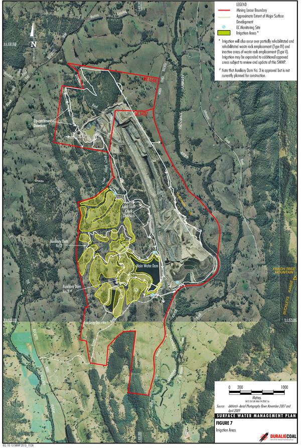
The stored dirty water is used on site for irrigation and dust mitigation. A mixture of pasture, woodland and cropping would be irrigated within the irrigation areas (Figure 18). Surface runoff from mine waste rock emplacements (prior to rehabilitation) would be intercepted and diverted to containment storages for reuse in the water management system. At the end of mining in 2019 (Heritage Computing, 2009), Coal Shaft Creek will be re-established. On average, DCM operates in surplus yielding more water from the mine and mine infrastructure catchments than needed for the mining and processing operations and continues disposal of excess water through irrigation.
Figure 17 Water storage areas in Duralie Coal Mine in the Gloucester subregion
Source: Duralie Coal (2013). This figure is not covered by a Creative Commons Attribution licence. It has been reproduced with the permission of Yancoal Australia.
Figure 18 Location of Duralie Coal Mine irrigation areas in the Gloucester subregion
Source: Duralie Coal (2013). This figure is not covered by a Creative Commons Attribution licence. It has been reproduced with the permission of Yancoal Australia.

Product Finalisation date
- 2.1.1 Geography
- 2.1.2 Geology
- 2.1.3 Hydrogeology and groundwater quality
- 2.1.4 Surface water hydrology and water quality
- 2.1.5 Surface water – groundwater interactions
- 2.1.6 Water management for coal resource developments
- Citation
- Acknowledgements
- Currency of scientific results
- Contributors to the Technical Programme
- About this technical product


