To maintain and protect the health of rivers and groundwater systems, the NSW government established water sharing plans (WSPs) for the state’s unregulated and regulated rivers under NSW’s Water Management Act 2000. The Act requires that water be allocated for the fundamental health of a water source and its dependent ecosystems, such as wetlands, floodplains and estuaries, as a first priority. These WSPs are reviewed every ten years.
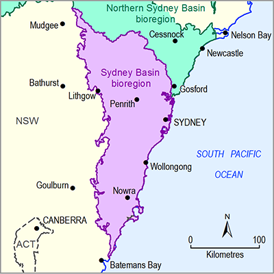
There are three WSPs wholly within the Sydney Basin bioregion (Table 18). The WSP for the Greater Metropolitan Region Unregulated River Water Sources covers an area of 32,500 km2 which includes most of the bioregion.
The Kangaroo River Water Source sits like an island within the larger area covered by the WSP for the Greater Metropolitan Unregulated River Water Sources. Its WSP commenced in 2004, well before the commencement of the WSP for the Greater Metropolitan Region Unregulated River Water Sources, in response to there being a high community dependence on water and a high risk to ecosystem values (NSW Department of Water and Energy, 2009). The 12 objectives specified in the plan reflect a range of environmental, economic, recreational and Indigenous values. DPI Water proposes to absorb the Kangaroo River Water Source into the WSP for Greater Metropolitan Region Unregulated River Water Sources in the near future.
Table 18 Water sharing plans for surface water resources in the Sydney Basin bioregion
aother water sources covered by this water sharing plan are not within the Sydney Basin bioregion and are not included here
The Upper Cudgegong River and Turon Crudine River water sources are managed under the WSP for the Macquarie Bogan Unregulated and Alluvial Water Sources. Alluvial water sources include surface water and groundwater and are managed conjunctively under the plan. As the plan name indicates, flows in these water source areas are unregulated.
The Jervis Bay-Clyde river basin is not currently part of a WSP, but a draft WSP for the Clyde River unregulated and alluvial water sources has been prepared and gone to public exhibition. It is anticipated to commence sometime after mid-2016.
The WSPs specify the share components of water licence holders in the different water source areas. A share component translates into the maximum volume of water that is permitted to be taken in a year under a licence. Table 19 summarises the total volumes of take permitted to be extracted by water source area in each WSP area. The Greater Metropolitan Region Unregulated River Water Sources WSP area has licensed entitlements totalling just over 1,195,000 ML/y, with the majority of this for water in the water source areas that contribute to the major storages created by the Warragamba, Avon, Cataract, Cordeaux, Tallowa, Nepean and Prospect dams (Table 16).
Table 20 summarises the share component information given in Table 19 in terms of the use for which the water has been licensed. Most (~86%) of the water is for town water supply, predominantly for the Greater Sydney population; 11% is extracted from the unregulated river for unspecified purposes; and a small volume (2%) is used for power generation.
Table 19 Surface water entitlements (ML/y) by water source area
Data: NSW Office of Water (Dataset 6)
Table 20 Licensed water use (ML/y)
|
Purpose |
Estimated water share component (ML/y) |
|---|---|
|
Town water supply |
1,043,088 |
|
Power generation |
29,021 |
|
Domestic and stock |
1,744 |
|
Unregulated river (not specified) |
132,982 |
Data: NSW Office of Water (Dataset 6)

