The Sydney Basin bioregion spans an area of 24,625 km2 immediately to the north, west and south of Sydney (Figure 3). It is bounded in the north by the Hunter subregion of the Northern Sydney Basin bioregion and extends to just south of Durras on the south coast of NSW. Its westward boundary is defined by the geological Sydney Basin. The bioregion includes the mining areas around Lithgow and Wollongong.
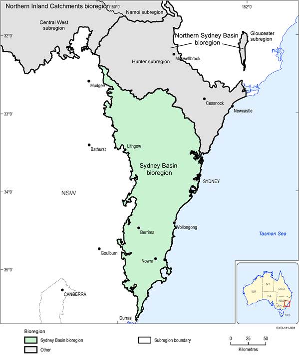
Figure 3 Sydney Basin bioregion
The Northern Sydney Basin bioregion and parts of the Northern Inland Catchments bioregion are also shown.
Data: Bioregional Assessment Programme (Dataset 1)
The Sydney Basin bioregion is defined from three data sources, being: (i) the geological Sydney Basin (Tadros, 1995; Geoscience Australia, Dataset 2), (ii) the Hawkesbury-Nepean and Central West surface water catchments (Geoscience Australia, Dataset 3) and (iii) the Australian coastline derived from the 1:250,000 topographic dataset (Geoscience Australia, Dataset 3). These are shown in Figure 4.
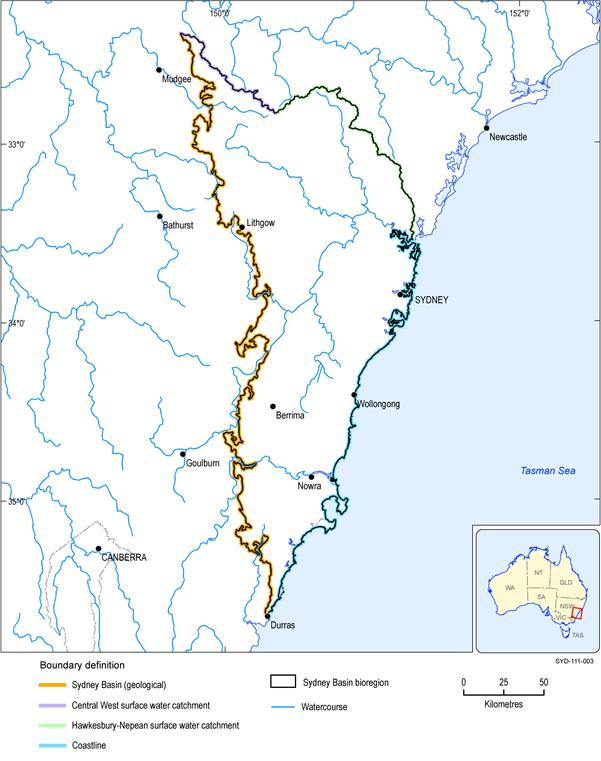
Figure 4 Boundary definitions of the Sydney Basin bioregion
Data: Geoscience Australia (Dataset 2, Dataset 3)
The surface water catchment boundary between the Hawkesbury-Nepean River system and the Hunter-Central Rivers systems conforms to the boundary between the former Hawkesbury-Nepean Catchment Management Authority (CMA) and the Hunter-Central Rivers CMA (DIPNR, 2003). It was this CMA boundary that was the basis for defining the Sydney Basin bioregion and Hunter subregion in 2012. On 1 January 2014, all CMAs in NSW transitioned into local land services (LLS) regions (NSW Government, 2014). Part of the Central-Coast portion of the Hunter subregion became part of what is now the Greater Sydney LLS region and part of the Hawkesbury-Nepean CMA area became part of the Hunter LLS (Figure 5).
