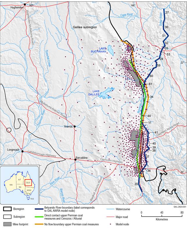
Analytic element modelling is grid independent and by default assumes aquifers and aquitards are of infinite extent. The eastern boundary of the upper Permian coal measures is implemented as a no-flow boundary in the model (Figure 10).
The direct contact between the upper Permian coal measures and the Cenozoic/alluvium aquifer is implemented as a linear feature in the groundwater analytic element model (GW AEM) in the centre of the area where upper Permian coal measures subcrop underneath the Cenozoic and Quaternary cover sediments. The linear feature allows groundwater levels in the upper Permian coal measures to locally equilibrate with groundwater levels in the Cenozoic/alluvium aquifer through a conductance term which represents the Cenozoic aquitard. In effect, this means groundwater extraction in the upper Permian coal measures can propagate directly to the Cenozoic/alluvium aquifer layer.
AWRA = Australian Water Resources Assessment; GAL = Galilee subregion
Data: Bioregional Assessment Programme (Dataset 1)
