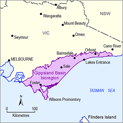
Surface water – groundwater interactions in the Gippsland Basin bioregion are summarised into three river region boundaries derived from the Australian Hydrological Geospatial Fabric (Geofabric – v2.1.1) (Bureau of Meteorology, 2013) as used in Section 1.1.5 Figure 30.
- South Gippsland – including waterways in the Tarwin Basin and Alberton Depression
- Mitchell–Thomson Rivers – including waterways in the highlands to the north of the bioregion, Moe Swamp Basin, Latrobe Valley Depression, Lake Wellington Depression and Seaspray Depression
- Snowy River–East Gippsland – including waterways east of Orbost.
Southern Rural Water (2012) generalised the key surface – groundwater interactions in the Gippsland Basin bioregion as:
- Local groundwater flow systems occurring around the basin margins along the flanks of the mountain ranges. Groundwater flow paths are steep and short before the water intercepts the ground surface in depressions and streambeds.
- Intermediate and regional groundwater flow systems occurring in the flatter gradients of the central floodplains and coastal sections of the Gippsland Basin. Shallow groundwater in these regions discharges to the Gippsland Lakes and surrounding wetlands. Deeper groundwater is thought to flow under the lakes and discharge offshore.
Two summary studies have calculated baseflow indices at various surface water gauging stations across the Gippsland Basin bioregion using the US Geological Survey hydrograph separation (HYSEP) (hydrograph separation) methodology, which analyses river gauge hydrographs to determine the likely contributions of baseflow as opposed to surface runoff (Minchin, 2010; Nicol, 2010). These baseflow indices range from 6% (runoff dominated) to 82% (baseflow dependent).
However, the results of different methods to identify gaining and losing behaviour are not universally consistent in the Gippsland Basin (Hofmann, 2011), suggesting that care must be taken when interpreting or using the results of surface water – groundwater interaction studies undertaken to date. For example, Hofmann (2011) identified a discrepancy in results between methods for baseflow analyses among differential surface water gauging stations versus singular river hydrograph analysis for the Avon and Mitchell river systems. The results from these different methods indicated that graphical hydrograph analysis techniques at a single site are biased towards gaining conditions (i.e. there is a component of baseflow if flow exists) while a differential water balance between an upstream and a downstream gauging station can be negative (i.e. losing reaches can be identified).
Hofmann and Cartwright (2013) concluded for the Gippsland Basin bioregion that the aquifer flow system revealed by geochemistry is more complex than could have been realised from groundwater levels alone (aquifers sampled encompassed the Haunted Hill Formation, Boisdale Formation, Baloock Formation, Strzelecki Group, Latrobe Group, Thorpdale Volcanics and Childers Formation). Baseflow to a river is highly variable along a river’s flow path (Hofmann, 2011). Furthermore, Hofmann (2011) detailed the importance of short- to medium-term bank storage of the Avon and Mitchell Rivers in the Gippsland Basin bioregion and the implications for distinguishing baseflow separation. Large flood events will recharge river banks, which then return groundwater from the banks without interacting with regional groundwater.

