- Home
- Assessments
- Bioregional Assessment Program
- Central West subregion
- 1.1 Context statement for the Central West subregion
- 1.1.5 Surface water hydrology and water quality
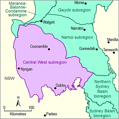
The Central West subregion of the Northern Inland Catchments bioregion includes the Macquarie, Castlereagh and Bogan river basins. Areas of the Macquarie river basin upstream of Wellington and areas to the west of the Bogan River lie outside of the subregion. The Macquarie is a regulated river. The three major public water storages in the Macquarie river basin, namely Burrendong, Windamere and Chifley dams, are all upstream of the subregion. There are several off-river storages and weirs in the Macquarie River and its tributaries, totalling 943 GL of storage capacity. The Macquarie Marshes lies in the lower reaches of the Macquarie River before it joins the Castlereagh River and flows into the Barwon-Darling River. There are seven off-river irrigation water supply schemes in the Macquarie river basin that are part of the Macquarie valley irrigation scheme. The Castlereagh is an unregulated river and there are no major public water storage dams in the Castlereagh river basin.
The Macquarie River downstream of Narromine is prone to major flooding. A Macquarie River floodplain management plan covers the area from Narromine to Oxley Station. Floodwaters escape from the Macquarie River channel and enter different creeks, shallow lakes and swampy depressions during high flows. The towns of Gilgandra and Nyngan in the Castlereagh and Bogan river basins, respectively, have experienced major floods in the past, notably in 1955, 1990, 2000 and 2010. In the downstream reaches, floodwater from the Barwon River flows into the Castlereagh River through connecting channels.
Water quality indicators such as total phosphorus, turbidity, electrical conductivity and water temperature are measured in the Macquarie and Castlereagh river basins. The total phosphorus concentration is higher than the Australian and New Zealand Environment and Conservation Council limits for protecting the aquatic ecosystem at almost all observation points in the Macquarie River, while the turbidity is mostly within the limits. For two sites in the subregion, electrical conductivity and water temperature data showed the median of mean monthly electrical conductivity to be below 553 mS/cm and the mean monthly temperature ranged from 5 to 30 °C.
There are more than 60 stream gauging stations in the Macquarie and Bogan river basins, some of which have more than 100 years of flow records. The Castlereagh river basin has about eight gauging stations whose data lengths vary from a few years to more than 60 years. Modelling using climate change projections for 2030 conditions indicates a likely decrease in future runoff.

