The surface water model nodes are the locations where streamflow predictions are made. In general, these nodes are located either:
- at streamflow gauges
- above major confluences
- immediately below proposed coal mine and coal seam gas (CSG) developments
- at locations required for receptor impact modelling.
In the Namoi subregion there are 54 model nodes based on the above criteria (Figure 4).
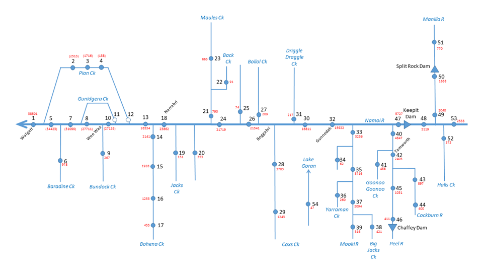
Numbers in red show the contributing area in km2.
Data: Bioregional Assessment Programme (Dataset 2)
More nodes would have helped get a better interpolation, but the aim is to position them strategically to determine maximum cumulative impacts at critical locations.
For ease of reporting (see Section 2.6.1.6), model nodes have been numbered from the most downstream node upstream, commencing with node 1 on the Namoi River at Walgett. Numbers progress along the main river channel and up each tributary with a node in the order that tributaries meet the main river channel (Figure 5).
