There are 28 sociocultural assets in the asset list for the Gwydir subregion with one of these coming from the National Heritage List (Australian Government Department of the Environment, Dataset 2) and the remainder being identified in the Register of the National Estate (Australian Government Department of the Environment, Dataset 3). They comprise 12 Indigenous sites, 10 heritage sites and 6 recreation areas. All 28 sociocultural assets are water dependent. The Gwydir subregion asset workshop (held in February 2015) did not nominate any additional sociocultural assets. Table 12 shows the breakdown of sociocultural assets.
The Indigenous assets include Wearmatong, Tikitere, Banarway, Bunna Bunna carved tree sites, the Warialda Axe Grinding Grooves site, Old Toomelah Cemetery, Moree Spa Baths, Euraba Mission, Boobera Lagoon Aboriginal Place and Berrygill Creek area. Larger Indigenous heritage areas include the Graman and the Terry Hie Hie Aboriginal areas (Figure 10).
The 10 heritage-classed sociocultural assets include Mount Kaputar National Park, which covers the largest area of all assets in the subregion and is shared with the Namoi subregion (Figure 10). The remaining heritage sites include six locations in Moree (such as the Mellor House) and the Tramby Graves.
The asset list and other details are available from the water-dependent asset register and asset list (Bruce and O’Grady, 2016) and the asset database (Bioregional Assessment Programme, Dataset 1).
Table 12 Number of water-dependent sociocultural assets according to subgroup and class in the Gwydir subregion
|
Subgroup |
Asset class |
Number of assets |
|---|---|---|
|
Cultural |
Heritage site |
10 |
|
Indigenous site |
12 |
|
|
Social |
Recreation area |
6 |
|
Total |
28 |
Data: Bioregional Assessment Programme (Dataset 1)
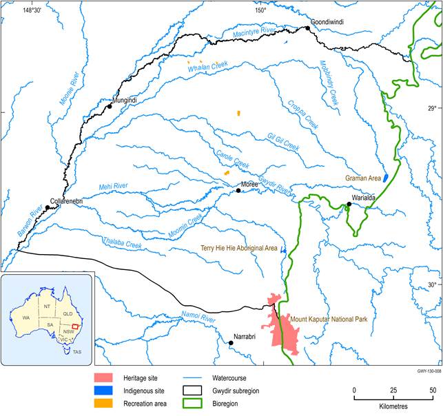
Figure 10 Location of sociocultural assets in the Gwydir subregion
Data: Bioregional Assessment Programme (Dataset 1), Australian Government Department of the Environment (Dataset 2, Dataset 3)
