Groundwater drawdown due to groundwater extraction is estimated using conservative numerical modelling. Potential impacts are of ‘low concern’ except where groundwater-dependent ecosystems that may access the Cenozoic aquifer are mapped in the west of the Cooper GBA region, or near existing bores where the saturated thickness of the Cadna-owie – Hooray aquifer is less than 150 m in the south-west of the Cooper GBA region. Alternative water sources, such as groundwater from other aquifers, or reuse of co-produced water, could avoid potential impacts on groundwater-dependent ecosystems or water bores in these areas.
Groundwater extraction causes a decrease in pressure and groundwater levels in the pumped aquifer in the vicinity of production bores that may propagate to over- or under-lying aquifers. To protect sensitive ecosystems, such as groundwater-dependent ecosystems (GDEs), prevention or mitigation options are required where predicted drawdown is greater than 0.2 m under established legal frameworks (NSW DPI, 2012; Queensland Government, 2000; South Australian Arid Lands Natural Resources Management Board, 2009). A 2-m aquifer drawdown threshold is used to assess interference with existing water users.
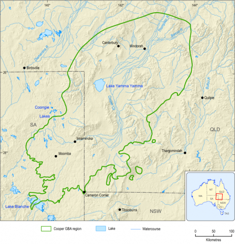
Any new groundwater extraction to support unconventional gas operations in the Cooper GBA region (refer to the civil construction , drilling , hydraulic fracturing , decommissioning and rehabilitation node descriptions) must adhere to relevant Queensland and South Australia regulations and water-sharing objectives without affecting other water users (including groundwater-dependent ecosystems). As the cost of drilling bores is proportional to the depth, the Cenozoic and Winton-Mackunda aquifers are the primary targets for groundwater because they are relatively shallow and salinity is not a major constraint (Holland et al., 2020). Water from Cadna-owie – Hooray system system bores is not preferred due to drilling depths greater than 1,000 m; however, petroleum exploration bores that intersect sections of the Cadna-owie – Hooray system may be repurposed into groundwater bores for production.
Conservative numerical modelling estimates of groundwater drawdown ( Box 4 ) in excess of 0.2 m are only of ‘potential concern’ across 0.9% of the Cenozoic aquifer’s distribution, where GDEs are mapped in the west of the Cooper GBA region. In these areas, potential impacts can be mitigated by extracting groundwater from deeper aquifers (such as Winton-Mackunda or Cadna-owie – Hooray). Groundwater drawdown is of ‘low concern’ in the Cenozoic and Winton-Mackunda aquifers where the saturated aquifer thickness is greater than 20 m, except within 1 km of existing bores where drawdown more than 2 m cannot be ruled out.
Groundwater drawdown in excess of 2 m cannot be ruled out within 1 km of existing bores that access the Cadna-owie – Hooray aquifer and where the saturated aquifer thickness is less than 150 m in the south-west of the Cooper GBA region (Geological and Bioregional Assessment Program, 2020b; Geological and Bioregional Assessment Program, 2021v). This occurs in less than 0.1% of the aquifer. There is high confidence in existing mitigation strategies, materiality thresholds and cause-and-effect relationships associated with drawdown due to groundwater extraction.
Box 4 Groundwater modelling without a development footprint
As detailed scenarios of groundwater extraction locations and volumes are not available, numerical models simulate groundwater extraction everywhere in the Cooper GBA region (refer to the groundwater extraction and the Cenozoic aquifer drawdown , Cadna-owie – Hooray aquifer drawdown and Winton-Mackunda aquifer drawdown node descriptions). Conservatively, it is assumed that 200 megalitres is extracted in one year for a single groundwater extraction bore in each grid cell. This is half of the average annual volume of water needed for the maximum resource development scenario (400 megalitres per year over 50 years).
Groundwater drawdown is estimated by considering three mechanisms: (i) drawdown from groundwater extraction in the same aquifer, (ii) drawdown from groundwater extraction in an over- or under-lying aquifer, and (iii) drawdown from depressurisation of an underlying gas reservoir. The model uses local information on layer thicknesses and the presence of faults, and conservative estimates of hydraulic properties based on regional measurements because local information is not available at the scale required (Geological and Bioregional Assessment Program, 2020b; Geological and Bioregional Assessment Program, 2021v).
Spills and leaks of liquid or solid contaminants can be unintentionally released to the environment beyond any engineered bunding or control, leading to aquifer contamination. Accidental release is of ‘potential concern’ when the concentration of a biological, chemical or physical property is sufficient to cause an adverse effect (refer to the soil contamination and surface water contamination node descriptions).
Conservative chemical transport modelling shows that contamination in the Cenozoic and Winton-Mackunda aquifers due to spills and leaks is of ‘potential concern’ where depth to groundwater is less than 9 m, and of low concern when groundwater is less than 14 m from the surface (Geological and Bioregional Assessment Program, 2021l, 2021t) ( Box 5 ). The chemical transport modelling also estimated dilution rates when contaminants travel through the aquifer. However, due to modelling constraints, aquifer contamination cannot be ruled out within 500 m of an existing water bore or GDE.
Potentially affected areas are predominantly along waterways in the central and western parts of the region and are of ‘potential concern’ in 0.2% of the Cenozoic aquifer, and in less than 0.01% of the Winton-Mackunda and Cadna-owie – Hooray aquifers. There is high confidence in existing mitigation strategies, materiality thresholds and cause-and-effect relationships associated with groundwater contamination due to accidental release.
Box 5 Natural attenuation and environmental fate of hydraulic fracturing chemicals
The quantitative assessment accounts for key landscape parameters that determine natural attenuation, such as soil type, depth to groundwater and groundwater velocity. Migration of chemicals through deep unsaturated zones is calculated with the HYDRUS-1D simulator, taking account of best-available hydraulic properties from a digital soil database. A 3-dimensional analytical solution of the advection–dispersion equation provides estimates of groundwater dilution. The modelling estimates when concentrations of chemicals in hydraulic fracturing fluids or flowback water accidentally released into the environment decrease to levels that are no longer considered harmful to the environment.
Waste disposal is of ‘low concern’ as it is unlikely to materially increase soil or aquifer contamination outside of licensed waste disposal sites. Stringent approval and management requirements ensure that contamination is effectively managed and/or mitigated.
Waste disposal is the handling, storage, transport and disposal of waste materials, excluding wastewater (refer to the controlled release of wastewater node description) and gases (refer to the atmospheric emissions node description), resulting from the construction, operation and decommissioning phases of production and processing activities needed for unconventional gas resource development. This includes disposal of brines and synthetic pond liners as regulated waste at a licensed waste facility (Department of Environment and Science (Qld), 2016). Waste disposal is unlikely to materially increase soil or aquifer contamination.
Reinjection of wastewater is managed by regulations and site-specific investigations to determine a suitable water quality similar to the receiving groundwater. Treatment of water to be reinjected is not required where investigations determine the water quality is suitable for the receiving environment (Santos, 2017; Commonwealth of Australia, 2014) (refer to the controlled release of wastewater node description).
Stringent approval and management requirements (refer to the controlled release of wastewater and waste disposal node descriptions) ensure that contamination is effectively managed and/or mitigated on site or at a licensed waste facility. Loss of containment during waste processing and disposal is described in the accidental release node description.
Product Finalisation date
- At a glance
- Explore this assessment
- Executive summary
- 1 About the assessment
- 2 About the region
- 3 Assessment, mitigation and monitoring
- 4 Potential impacts on water
- 5 Potential impacts on the environment
- 6 Potential impacts on protected fauna and flora
- 7 Conclusion
- References
- Glossary
- Contributors to the Program
- Acknowledgments