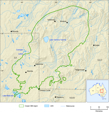
There are 3 major geological basins in the Cooper GBA region: the Cooper Basin, the Eromanga Basin and the Cenozoic sediments of Lake Eyre Basin (Figure 3). In the Cooper Basin, the Permian Gidgealpa Group hosts the unconventional gas resources and is overlain by the Nappamerri Group. Due to depth of burial (generally greater than 1,500 m), the Cooper Basin is not directly used as a groundwater source. Between 600 and 2,000 m of sedimentary rock typically separates aquifers, such as those in the Cenozoic and Winton-Mackunda formations or deeper Great Artesian Basin (GAB) aquifers, from shale, tight and deep coal gas plays in the Cooper Basin (Section 3.1 in baseline synthesis and gap analysis (Holland et al., 2020); hydrogeology technical appendix (Evans et al., 2020)).
The Cadna-owie – Hooray aquifer is an artesian aquifer, where the natural water pressure in a bore can rise to the ground surface. It is hosted in the Cadna-owie and Murta formations, and the Hooray, Namur and Algebuckina sandstones, which are part of the Great Artesian Basin (GAB). The Winton-Mackunda aquifer is a sub-artesian aquifer, which covers the entire Cooper GBA region and includes outcrops, as well as confined areas where it is overlain by significant thicknesses of Lake Eyre Basin sediments (Cenozoic aquifer). The Cenozoic aquifer is the uppermost aquifer, which covers parts of the Cooper GBA region where the older Winton Formation sediments do not outcrop. The Cenozoic and unconfined parts of the Winton-Mackunda aquifer support groundwater-dependent ecosystems where the watertable is near the surface in the west of the Cooper GBA region.
FIGURE 4 Cooper Basin structural elements overlain on the top of the pre-Permian basement depth horizon

Product Finalisation date
- At a glance
- Explore this assessment
- Executive summary
- 1 About the assessment
- 2 About the region
- 3 Assessment, mitigation and monitoring
- 4 Potential impacts on water
- 5 Potential impacts on the environment
- 6 Potential impacts on protected fauna and flora
- 7 Conclusion
- References
- Glossary
- Contributors to the Program
- Acknowledgments

