The causal network is used to identify potential impacts on protected environmental assets and values – represented by 13 environment-related endpoints in the causal network. Assessment results can be used to identify existing avoidance and mitigation strategies and to prioritise local-scale assessment, mitigation and monitoring. Environment-related endpoints include agricultural productivity, 4 key vegetation communities (dryland, floodplain, riparian and wetland; Figure 12 ), and 9 protected areas. Pathways of ‘potential concern’ between unconventional gas resource development activities and environment-related endpoints are primarily related to activities that create a disturbance at the surface (transport of materials and equipment, civil construction, decommissioning and rehabilitation, and seismic acquisition). Potential impacts at the surface include contamination; reduced flooding; habitat degradation, fragmentation and loss; increased competition and predation; and mortality of native species. The assessment is supported by findings from field data collection and analysis of remote sensing data (Box 7, Box 8, Box 9).
FIGURE 12 Key vegetation communities in the Cooper GBA region
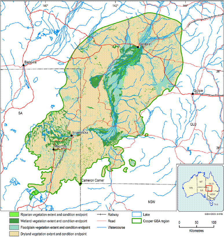
Data: Geological and Bioregional Assessment Program (2021c)
Element: GBA-COO-3-616