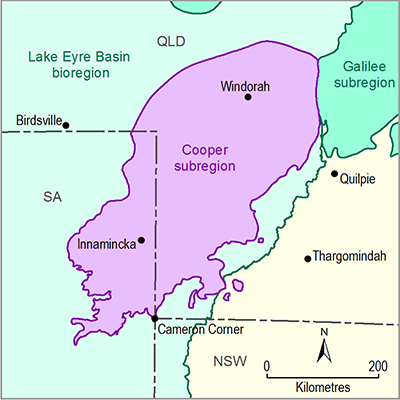
1.1.4.1.1 Cooper Basin
The Cooper Basin consists of alternating sandstone and siltstone units, with varying degrees of interbedded coarser and finer units, and coal seams. This can provide a useful hydrostratigraphic framework with which to begin characterising the groundwater systems. The SA Department for Water provided a hydrostratigraphic framework for the Cooper Basin (Table 6). While geologically distinct from the Cooper Basin sequence, the Cuddapan Formation is included in this framework. Toupin et al. (1997) and Golder Associates (2011) provide slightly different hydrostratigraphic characterisations, which are also summarised in Table 6 . Gravestock et al. (1998) characterised the Cooper Basin rocks in terms of their potential as hydrocarbon reservoirs and seals. This classification also provides valuable information on hydrogeological parameters. Gray and Draper (2002) provide a similar summary of the reservoir and seal characteristics for the Cooper Basin in Queensland. These were compiled by Radke (2009) and are presented in Table 6 for comparison. In all classifications, coarser sandstone units of the Patchawarra and Toolachee formations represent the highest porosity units, with workers considering the Tinchoo, Patchawarra, Epsilon, Daralingie and Toolachee formations, along with the Tirrawarra Sandstone and Merrimelia Formation to be reservoir units (Gravestock et al., 1998; Gray and Draper, 2002; Radke, 2009). Table 6 also enables the reservoir and seal framework to be correlated with an aquifer and aquitard framework.
Table 6 Comparison between the various hydrostratigraphic frameworks for the Cooper Basin
|
|
Unit |
Hydrogeology |
Hydrostratigraphic Unit Description (Toupin et al., 1997) |
Hydrogeological characteristics (Golder Associates, 2011) |
Reservoir or seal |
|---|---|---|---|---|---|
|
Triassic |
Cuddapan Formation |
Aquifer |
Not included |
Not characterised |
Reservoir |
|
Tinchoo Formation |
Aquifer |
Confining bed |
Confining beda |
Reservoir |
|
|
Arrabury Formation |
Major aquitard |
Confining bed |
Confining bed |
Seal |
|
|
Permian |
Toolachee Formation |
Aquifer |
Confining bed Sandstone aquifer |
Aquifer |
Reservoir |
|
Daralingie Formation |
Aquifer and aquitard |
Sandstone aquifer |
Confining bed |
Reservoir |
|
|
Roseneath Shale |
Aquitard |
Sandstone aquifer |
Confining bed |
Seal |
|
|
Epsilon Formation |
Aquifer |
Sandstone aquifer |
Aquifer |
Reservoir |
|
|
Murteree Shale |
Aquitard |
Confining bed |
Confining bed |
Seal |
|
|
Patchawarra Formation |
Aquifer |
Confining bed Sandstone aquifer |
Aquifer |
Reservoir |
|
|
Tirrawarra Sandstone |
Aquifer |
Sandstone aquifer |
Aquifer |
Reservoir |
|
|
Carboniferous |
Merrimelia Formation |
Aquifer |
Not included |
Water bearing |
Not Classified |
Source: Golder Associates (2011); Radke (2009); SA Department for Water (2011); Toupin et al. (1997)
aGolder Associates (2011) split the Tinchoo Formation into the Gilpeppe and Doonmulla members, and the Arrabury Formation into the Wimma Sandstone, Paning and Callamurra members. Of these, only the Wimma Sandstone Member is characterised as an aquifer.
1.1.4.1.2 Eromanga Basin
The Eromanga Basin covers all of the Cooper Basin and is considered as a series of stacked aquifers separated by aquitards. Kellett et al. (2012) proposed a qualitative classification of the hydrogeological units to account for variation in hydraulic properties that may be due to one or a combination of sediment sources, rates of basin subsidence during deposition, and alteration since the time of deposition. It has been subdivided by Kellett et al. (2012) into two hydrogeological systems: a Jurassic to Early Cretaceous hydrogeological system and a Rolling Downs Group hydrogeological system.
The Eromanga sequence reaches over 3000 m thick in the Central Eromanga Depocentre in the subregion (SA Department for Water, 2011). Disruptions to aquifer continuity can occur where displacements across a fault significantly offset an aquifer system. Significant fault offsets are evident at the eastern margin of the Cooper subregion, along the Canaway Fault (see Section 1.1.3.1.2). Another geological feature which may potentially compromise the effectiveness of the Wallumbilla Formation aquitard in the subregion is a pervasively developed polygonal faulting (Kellett et al., 2012) extending across the entire Central Eromanga Depocentre (Figure 2 in Section 1.1.3).
The Cadna-owie Formation and Algebuckina Sandstone together are the main aquifers in the subregion. This aquifer system is both artesian and non-artesian. Kellett et al. (2012) notes a reduction in permeability with increasing depth in the Hutton Sandstone and Cadna-owie Formation within the Central Eromanga Depocentre due to burial diagenetic effects. Similar effects can be seen in the other Eromanga Basin hydrostratigraphic units. Where confined, the Cadna-owie – Algebuckina aquifer system is overlain by the Bulldog Shale.
Along the south-western margin of the Eromanga Basin, the Bulldog Shale is in turn overlain by the Coorikiana Sandstone, which forms a discrete aquifer of high salinity and low yield. Artesian pressures have been recorded in this aquifer. Due to its high salinity and low yield, this aquifer is generally not exploited (SA Department for Water, 2011).
The upper aquifer of the Great Artesian Basin (GAB) occurs in the Winton and Mackunda formations. It is separated from the lower confined Cadna-owie – Algebuckina aquifer system by shale of the Oodnadatta Formation and Bulldog Shale, and is generally overlain by Cenozoic sediments of the geological Lake Eyre Basin. Aquifers in the Winton and Mackunda formations may be confined where overlain by significant thicknesses of the Lake Eyre Basin, but are unconfined where it outcrops (SA Department for Water, 2011).
1.1.4.1.3 Cenozoic
Aquifers occur in the Cenozoic rocks of the geological Lake Eyre Basin in the Cooper subregion. The Eyre and Namba formations are considered to be aquifers, while the other more clay rich units generally form aquitards, or leaky aquitards. The aquifers vary between unconfined and confined (SA Department for Water, 2011).
Water can be obtained from near-surface sedimentary materials, some of which may have been affected by secondary cements. Generally they are unconfined, with the depth to watertable up to 90 m (SA Department for Water, 2011).

