The Jeebropilly Mine west of Ipswich, Queensland is the only coal mine in the baseline coal resource development (baseline) for the Clarence‑Moreton bioregion. In addition to this coal mine, the CRDP includes only one additional coal resource development (ACRD), which is named as West Casino Gas Project in companion product 2.3 (conceptual modelling) for the Clarence‑Moreton bioregion (Raiber et al., 2016) (Figure 3). The West Casino Gas Project occurs in the central part of the Richmond river basin, while the Jeebropilly Mine is distant and hydrologically disconnected from the CSG project as described in companion product 2.3 for the Clarence‑Moreton bioregion (Raiber et al., 2016). Thus, the water balance analysis, surface water modelling, and groundwater modelling was only carried out for the Richmond river basin area.
A groundwater model has been developed to assess the potential impacts of the West Casino Gas Project on the groundwater system and associated groundwater-dependent ecosystems in companion product 2.6.2 for the Clarence‑Moreton bioregion (Cui et al., 2016). This water balance analysis is based on the groundwater modelling results. The groundwater balance analysis was conducted for the entire groundwater model domain in order to capture any possible changes in water balance due to the West Casino Gas Project. The groundwater model covers an area of 8230 km2 and mostly follows the boundaries of the Richmond river basin with deviations in some areas as outlined in companion product 2.3 (conceptual modelling) for the Clarence‑Moreton bioregion (Raiber et al., 2016). The groundwater model boundary is shown in Figure 3. A more detailed description of the groundwater model is found in companion product 2.6.2 for the Clarence‑Moreton bioregion (Cui et al., 2016).
A surface water Australian Water Resources Assessment landscape model (AWRA‑L) has been developed to assess the potential impacts of the West Casino Gas Project on the surface water system (see companion product 2.6.1 for the Clarence‑Moreton bioregion (Gilfedder et al., 2016)). The surface water balance analysis is reported at three locations which are either in or very close to the West Casino Gas Project: Eden Creek (model node CLM002), Shannon Brook above Yorklea (model node CLM007), and Richmond River above Casino (model node CLM008) (Figure 3). It is also reported for the Richmond River above Kyogle (model node CLM014) to ensure that any groundwater impacts propagating north along the Richmond river valley are estimated. A more detailed description of the surface water model is found in companion product 2.6.1 for the Clarence‑Moreton bioregion (Gilfedder et al., 2016).
The water balances are reported for three 30‑year periods (2013 to 2042, 2043 to 2072 and 2073 to 2102) for both the baseline and CRDP. These three periods align with temperature increases of 1.0, 1.5 and 2.0 °C from current, under a future climate projection derived from the CSIRO‑Mk3.0 global climate model (GCM) (Viney, 2016). Only a single future climate time series was used during the modelling for water balance analysis. The climate time series was generated by concatenating the 30‑year series (1983–2012) three times, and scaled by a median climate change projection.
The time to maximum hydrological change will be different for different water balance terms such as surface water outflow and storage change, which means that at the bioregion level there is not a single point in time for which a maximum change on water balance can be constructed. Thus, the water balance changes are not reported as a maximum and its associated occurring time.
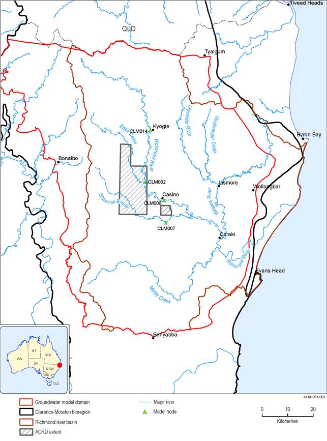
Figure 3 Location of model nodes for surface water balance terms for the Clarence-Moreton bioregion
ACRD = additional coal resource development
Data: Bioregional Assessment Programme (Dataset 1)
