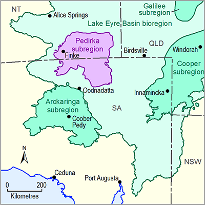
Groundwater is the most significant water resource for the Pedirka subregion, and is primarily extracted from local bores for stock and domestic purposes. The Jurassic to Cretaceous age aquifers of the Great Artesian Basin (GAB) are the main groundwater source (particularly the so-called ‘J aquifer’), and are widely used to supply water for pastoral stations and homesteads, and some remote Indigenous communities. The J aquifer in the GAB comprises the Cadna-owie Formation, Algebuckina Sandstone and the De Souza Sandstone. Natural groundwater discharge from GAB aquifers is also thought to occur in some areas of the subregion (Miles et al., 2013), and may contribute to maintaining springs, other groundwater-dependent ecosystems and diffuse discharge zones. Some groundwater discharge in the Pedirka subregion may also be sourced from deeper hydrostratigraphic units, such as the Permian aquifers of the geological Pedirka Basin.
Groundwater salinity in the J aquifer of the GAB is in the range of about 250 to 5000 mg/L total dissolved solids (TDS) across the Pedirka subregion (Wohling et al., 2013). The freshest groundwater occurs near interpreted aquifer recharge zones along the Finke River. Some groundwater isotope data also exist for the GAB in the Pedirka subregion, and interpretation of these data suggests that modern and active groundwater recharge occurs to the J aquifer from episodic flood events within these surface water systems (Love et al., 2013).
There is only limited hydrochemistry data available for groundwater sourced from the Permian Crown Point aquifer in the geological Pedirka Basin. These data indicate that groundwater has variable salinity within the range of about 100 to 8000 mg/L TDS. The mean groundwater salinity of the Permian aquifer is about 2500 mg/L, and the freshest groundwater is tapped by bores that occur close to the Finke River and Goyder Creek (Miles et al., 2015).
Groundwater quality in the near-surface Cenozoic aquifers of the Pedirka subregion is highly variable (ranging from 300 to 10,240 mg/L TDS), with the mean groundwater salinity about 2400 mg/L TDS (Miles et al., 2015). Similar to the deeper aquifers, the freshest groundwater in Cenozoic aquifers occurs near local surface water sources which are episodically flooded.
Data and information required to further assess groundwater quality in the Pedirka subregion are primarily held by the SA Government’s WaterConnect website (DEWNR, 2015) and the NT Government’s Water Data Portal website (DLRM, 2015). Some additional data are also available from the Bureau of Meteorology (Bureau of Meteorology, 2014).
The extent of groundwater quality data across the Pedirka subregion is very sparse, and for many aquifers there are no data publicly available. The information that would be required to conduct a more detailed groundwater quality assessment to better understand interactions between different aquifers and surface water systems includes:
- location information for all groundwater monitoring points, including the aquifer(s) from which the samples were collected
- information on the time of groundwater sample collection and analyses undertaken
- laboratory results of groundwater quality analyses. These would include major and trace ion water analyses, groundwater field parameter measurements and isotopic data.
Further information about groundwater quality is outlined in companion product 1.1 for the Pedirka subregion (Miles et al., 2015). Wohling et al. (2013) is another key reference on groundwater quality for the Pedirka subregion. It details recent work on the geological and hydrogeological conceptualisation of the Pedirka subregion and summarises existing water quality data, including maps that show variations in groundwater salinity.

