- Home
- Assessments
- Bioregional Assessment Program
- Pedirka subregion
- 1.5 Current water accounts and water quality for the Pedirka subregion
Executive summary

Information on surface water and groundwater quantity and quality for the Pedirka subregion is documented in this product. This information was captured in October 2015 and was used in the evaluation of the potential impact of coal seam gas and coal mining development on water and water-dependent assets.
Coal and coal seam gas resource development in the Pedirka subregion is very low and so no new modelling was undertaken as part of this assessment. Beyond early exploration stages, there are no known proposals identified for coal or coal seam gas in the Pedirka subregion.
Water accounts
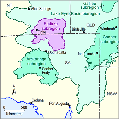
The Pedirka subregion includes the mid to lower Finke river basin, the north-central Macumba river basin and the lower floodplain of the Hale river basin. Much of the Pedirka subregion is arid sandy desert with surface water flow occurring only after high-intensity rainfall events.
Due to unreliable surface water flows in this subregion there are no surface water allocations.
Groundwater is the most significant water resource in the Pedirka subregion. These resources are mainly extracted from aquifers of the Great Artesian Basin.
In South Australia, groundwater allocations within the Great Artesian Basin and Far North Prescribed Wells Area are regulated by the South Australian Government. Most of the water extracted in the Pedirka subregion is for pastoral use.
In the Northern Territory, most groundwater within the Pedirka subregion is managed by the Great Artesian Basin Northern Territory Water Allocation Plan. On an annual basis, about 3.5 gigalitres is allocated under this plan.
Water quality
Information on surface water quality in the Pedirka subregion is sparse due to the unreliability of surface water flows and the remoteness of the subregion. Data exists for only a few waterholes in the Finke and Macumba river basins.
Great Artesian Basin aquifers are the main groundwater source supplying pastoral stations, homesteads and some Indigenous communities. They also maintain springs and wetlands in the Pedirka subregion.
Groundwater salinity levels are highly variable across that part of the Great Artesian Basin that underlies the Pedirka subregion, with the freshest groundwater occurring along recharge areas of the Finke River.
The extent of groundwater quality data across the Pedirka subregion is very sparse, and for many aquifers there are no data publicly available.
More information about surface water and groundwater in the Pedirka subregion can be found in the context statement.

