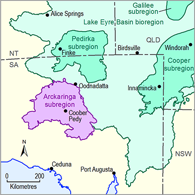
The main surface water system in the Arckaringa subregion is the Neales-Peake river basin, an eastward flowing system that drains into Kati Thanda – Lake Eyre. The river basin consists of ephemeral and unregulated rivers that are typified by multiple, complex and generally shallow anastomosing channels, as well as wide floodplains and waterholes. Surface water flow in this river basin typically only occurs following local, high-intensity rainfall events commonly associated with storms. In-channel waterholes occur in parts of the Neales-Peake river system, but most are of relatively small volume and generally shallow (<1 m deep), although there are rare, deeper waterholes (2 to 4 m deep) that are near-permanent.
Due to the unreliability of surface water flows in the Arckaringa subregion, they are not relied upon as a water supply source for stock, agriculture, mining or domestic purposes. Consequently, there are no current surface water allocations for the Arckaringa subregion. All water allocations granted by the SA Government within this subregion relate to the use of groundwater resources. Further information about the surface water hydrology is outlined in companion product 1.1 for the Arckaringa subregion (Miles et al., 2015). Montazeri and Osti (2014) reported on a hydrological catchment model developed for the Neales-Peake river basin. Other relevant references include Wakelin-King (in press) and Wohling et al. (2013), both of which summarise the hydrology of the Arckaringa subregion.
Some available surface water data can be sourced from the South Australian Government Department of Environment, Water and Natural Resources (DEWNR) WaterConnect website (DEWNR, 2015).

