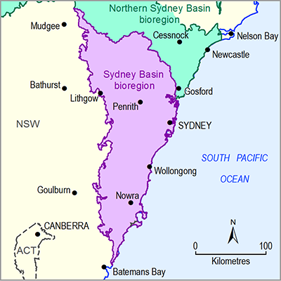
As part of the National Water Account (NWA), the Bureau of Meteorology prepares an annual surface water account for the Sydney region. Having significant overlap with the Sydney Basin bioregion, this water-reporting region should be the primary source of information about water availability, annual water flows, water supply and treatment systems, water use and water management. The NWA for the Sydney region has been undertaken since 2009–10 (Bureau of Meteorology, 2011, 2012, 2013, 2014, 2015). It does not include groundwater in the water accounting statements, but provides contextual information about groundwater resources and management.
The production of the NWA for the Sydney region involves close collaboration with NSW state agencies responsible for water data collection. In particular, DPI Water (formerly the NSW Office of Water) and WaterNSW (formerly Sydney Catchment Authority and State Water Corporation) provide data, check numbers and review sections of the report to ensure that it is the best possible summary of the annual water situation given the available information. Table 3 summarises surface water data and information available for the Sydney Basin bioregion.
Table 3 Sources of surface water data and information for constructing a surface water account in the Sydney Basin bioregion
|
Custodian |
Data |
Sources |
|
Bioregional Assessment Programme |
Surface water entitlements Surface water sharing plan areas |
NSW Office of Water (Dataset 1, Restricted access) NSW Office of Water (Dataset 2) |
|---|---|---|
|
Bureau of Meteorology |
Climate: rainfall, temperature, net radiation |
Online portal to:
|
|
Australian landscape water balance outputs: runoff, potential evapotranspiration, actual evapotranspiration, deep drainage, soil moisture |
Online portal to the Bureau of Meteorology’s modelled daily landscape water balance data (Bureau of Meteorology, 2016c) |
|
|
Water storages |
Online portal to the Australian Water Resources Information System (AWRIS) data, which can be easily compared across different regions. Information about daily water storage levels and volumes is generated at different scales, such as by state, by storage or by drainage division (Bureau of Meteorology, 2016d) |
|
|
Streamflow |
Online portal to the Bureau of Meteorology’s water data (Bureau of Meteorology, 2016e) |
|
|
National water accounts |
Website for the national water accounts, Australia’s most comprehensive water information report (Bureau of Meteorology, 2011, 2012, 2013, 2014, 2015) |
|
|
Urban national performance reports |
Website for the national performance reports which benchmark the pricing and service quality of Australian water utilities (Bureau of Meteorology, 2016f) |
|
|
Water entitlements Water markets |
Website for national water markets (Bureau of Meteorology, 2016g) |
|
|
DPI Water |
Streamflow |
Online portal for real-time data providing daily updates on entire river systems (DPI Water, 2016a) |
|
Water sharing plans |
Online pages about water sharing plans including those already commenced (DPI Water, 2016b) |
|
|
Water register |
Online portal for accessing the NSW Water Register which provides public access to information about water licences, approvals, water trading, water dealings, environmental water and other matters related to water entitlements in NSW (DPI Water, 2016c) |
|
|
NSW Government |
State legislation:
|
NSW Government website for online publication of legislation (NSW Government, 2016) |
|
Sydney Water |
Annual reports (town water supply) |
Online publications pages including annual reports (Sydney Water, 2016a) |
|
Weekly water supply report |
Online reports from web pages about managing Sydney’s water network (Sydney Water, 2016b) |
|
|
WaterNSW |
Annual reports |
Online publications pages including annual reports (WaterNSW, 2016a) |
|
Water storages (daily) Streamflow (daily) |
Online portal for current (24-hour) levels across NSW (WaterNSW, 2016b) |
|
|
Fish River water balance reporting |
Online water balance reporting by valley, for each of the regulated river systems. These water balances describe where the water originated and where it went (WaterNSW, 2016c) |

