The cross-sections of the geological units (in the Bowen, Surat and Clarence-Moreton geological...
Figure 3 The cross-sections of the geological units (in the Bowen, Surat and Clarence-Moreton geological basins) that are in the regional watertable, and the locations where units outcrop at the surface towards the north and east of the subregion
Figure 3 The cross-sections of the geological units (in the Bowen, Surat and Clarence-Moreton geological basins) that are in the regional watertable, and the locations where units outcrop at the surface towards the north and east of the subregion
The cross-sections of the geological units (in the Bowen, Surat and Clarence-Moreton geological...
Figure 3 The cross-sections of the geological units (in the Bowen, Surat and Clarence-Moreton geological basins) that are in the regional watertable, and the locations where units outcrop at the surface towards the north and east of the subregion
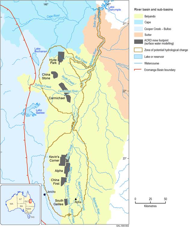
Data register
This page lists all of the datasets and subsets used by the figure shown within the product section or submethodology section named below.
The data links listed on this page connect to the relevant landing page on the information service data.gov.au. From this external site publically available datasets may be downloaded.
This information is provided to enable the identification, review and understanding of the datasets used in the bioregional assessments and their origins. This list of datasets enhances the transparency of the science by the Bioregional Assessments Programme.